

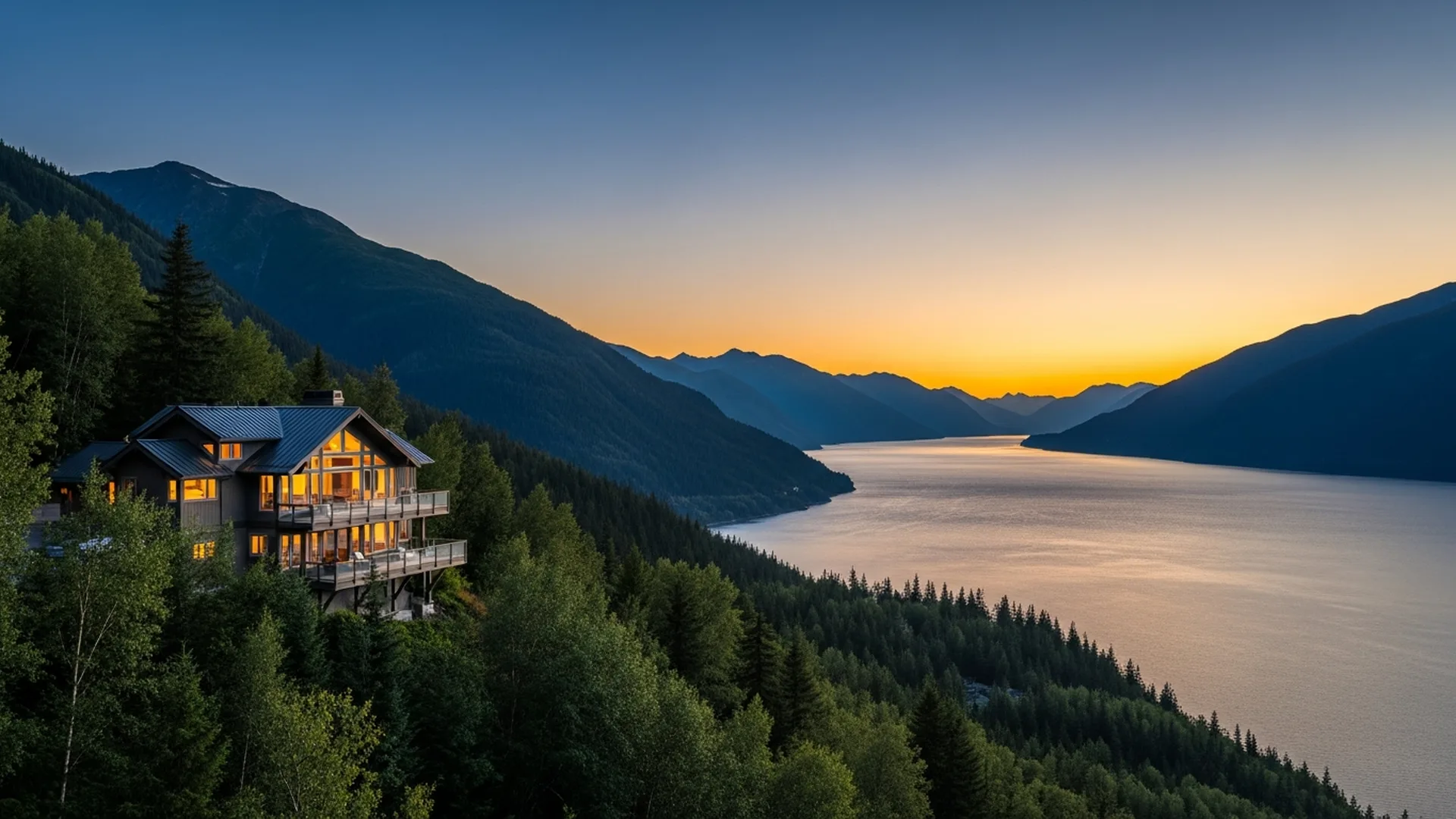
Bird and Indian are small communities on the north shore of Turnagain Arm, strung along the Seward Highway roughly 20 to 25 miles southeast of downtown Anchorage and about 12 to 15 miles short of Girdwood, all within the Municipality of Anchorage. Homes here trade proximity to the city for south-facing water-and-mountain views, larger and often unrestricted parcels, and a distinctly rural feel. The essential due diligence is specific: most properties rely on a private well and on-site septic, so a Municipality Certificate of On-Site Systems Approval (COSA) is required at sale; the Seward Highway is the only road and runs through a high-frequency avalanche and rockfall zone; and building here means designing for a Girdwood-area ground snow load of 140 psf near sea level, versus 50 psf in the Anchorage bowl.
Most buyers first meet this corridor as scenery. You drive the Seward Highway south of Anchorage, the road narrows against the cliffs, Turnagain Arm opens up below, and somewhere past Beluga Point you start wondering what it would be like to live here. I’ve watched people fall for that view for forty years — and I’ve watched the ones who buy well treat the view as the reward for getting the harder questions right first.
Bird and Indian aren’t a subdivision with a sign and a gate. They’re a loose string of homes, cabins, and view parcels tucked between the Chugach and the water, functionally the on-ramp to Girdwood. Buying here rewards patience and local knowledge more than almost anywhere else in the Anchorage market, because the things that matter most — water, road, snow, and land use — don’t show up in a listing photo.
- Bird (near Seward Highway Milepost 101) and Indian (near Milepost 103) sit on the north shore of Turnagain Arm inside the Municipality of Anchorage, about 20–25 minutes from downtown and 15–20 minutes from Alyeska.
- Most parcels are on private well and septic, not city utilities — which triggers a required Certificate of On-Site Systems Approval (COSA) at title transfer under Municipal ordinance dating to 1998.
- The Seward Highway is the sole road access and runs through a high-frequency avalanche area; Alaska DOT&PF triggers slides with artillery, and closures of several days have occurred.
- Spring break-up brings recurring rockfall and ice-fall onto the highway; the state has an active multi-million-dollar rockfall mitigation project between Potter Marsh and Bird Flats.
- Girdwood-area ground snow load is set at 140 psf for elevations up to 300 feet — nearly triple the 50 psf used in the Anchorage bowl — so roof and structure design is a serious cost and safety factor.
- Short-term rentals fall under Anchorage’s new 2026 registration program and a 12% room tax; Girdwood already has a very high vacation-rental concentration and further regulation is under discussion.
- South-facing lots capture Turnagain Arm’s water, the Kenai Mountains beyond, and up to ~40-foot tides — a rare view combination, balanced against the steep-slope hazards behind the homes.
Where Are Bird and Indian, and How Do They Fit Into the Girdwood Corridor?
Both communities lie on the north shore of Turnagain Arm, the long tidal branch of Cook Inlet that the Seward Highway follows south out of Anchorage. Turnagain Arm communities within the Municipality of Anchorage include Indian, Bird, and Girdwood, all along that north shore. Indian is the community up near Milepost 103, home to the Indian Valley Mine National Historic Site; Bird Creek sits a couple of miles down the road near Milepost 101, with the popular Bird Point scenic overlook near Milepost 96.
Practically, this is the stretch you pass through on the way to Alyeska. From Indian, downtown Anchorage is roughly a 20-to-25-minute drive in good conditions, and Girdwood is another 15 to 20 minutes southeast where the Alyeska Highway branches off the Seward Highway near Milepost 90. The paved Bird-to-Gird pathway — a 13-mile multi-use trail built largely on the old highway alignment — physically links Indian, Bird, and Girdwood, which tells you how tightly this corridor functions as one recreational world even though the homes are spread thin.
| Landmark | Approx. Seward Hwy Milepost | Note |
|---|---|---|
| Potter Marsh | ~MP 117 | Northern gateway; wildlife refuge |
| Beluga Point | ~MP 110 | Scenic turnout, bore-tide viewing |
| Indian | ~MP 103 | Indian Valley Mine historic site |
| Bird Creek | ~MP 101 | Campground, salmon run, Bird-to-Gird trail |
| Bird Point overlook | ~MP 96 | 180° Turnagain Arm views |
| Alyeska Hwy junction (to Girdwood) | ~MP 90 | 3 miles to Alyeska Resort |
What Do the Views and the Land Look Like on Turnagain Arm?
This is the draw, and it’s a genuine one. North-shore lots face south and southwest across the water, so you’re looking at Turnagain Arm with the Kenai Mountains beyond and the Chugach rising directly behind the house. Turnagain Arm carries some of the largest tides in North America — up to roughly 40 feet — and on the right conditions produces a bore tide, a wave that rushes up the arm. It’s a living view that changes hour to hour, which is something a flat inlet view in town can’t offer.
Unlike the platted Hillside subdivisions in town, parcels out here tend to be larger, more wooded, and frequently without an HOA or heavy covenants — part of the rural appeal. That freedom cuts both ways: fewer covenants also means fewer guarantees about what a neighbor can build or how a shared driveway is maintained, so I read the plat, the easements, and any recorded restrictions carefully on every one of these.
What buyers love here
- South-facing water + mountain views with dramatic tides
- Larger, wooded, often unrestricted parcels
- Quiet, rural feel with Anchorage still ~20–25 min away
- Direct access to Bird-to-Gird trail, Chugach State Park, Alyeska
What buyers must plan for
- Well & septic ownership and the required COSA at sale
- Single-road access with avalanche + rockfall closures
- Heavy snow-load design and winter maintenance costs
- Short-term-rental rules that are actively changing
What Should You Check on a Well-and-Septic Property in Bird or Indian?
Because these outlying properties generally aren’t on the Anchorage Water & Wastewater Utility system, most rely on a private well and an on-site septic system. That single fact drives one of the most important pieces of due diligence in the entire corridor. Under a Municipal ordinance in effect since August 1998, a Certificate of On-Site Systems Approval — a COSA — is required to transfer title on any Municipality of Anchorage property served by a well or septic system (with narrow exceptions such as transfers between spouses or to a family trust).
The COSA isn’t a formality. A State-of-Alaska-registered civil or environmental engineer must flow-test the well, test the septic absorption field, and sample water quality, then submit the package to the Municipality’s On-Site Water and Wastewater Section for approval. Per one Anchorage brokerage’s published breakdown, the Municipality’s inspection fee has run in the range of a few hundred dollars, with the engineer’s testing on top — but the real exposure is a system that fails and needs replacement, where bids have ranged from roughly $10,000 to $30,000 depending on soils and design. My rule for sellers here is simple and unlike the “list first, deal with it later” instinct: test the well and septic early in the process, before it can delay or kill a sale.
Winter timing matters. If a septic system fails and the ground is frozen, the Municipality can issue a conditional COSA once testing requirements are met, but selling then typically requires an escrow of roughly one and a half times the highest replacement bid until the work can be completed. That’s a real cash-flow consideration for a winter closing in this corridor.
How Does Winter Highway Access Really Work in This Corridor?
The Seward Highway along Turnagain Arm is a nationally designated scenic byway and also, in the words of Alaska’s transportation department, a high-frequency avalanche area — strong winds off the arm cross-load the slopes above the road. Alaska DOT&PF runs a dedicated avalanche program: specially trained crews use military artillery and other methods to trigger slides deliberately, which creates intermittent traffic delays that typically last about 45 minutes, though longer holds happen. The department has documented periods where the road between Anchorage and Girdwood was closed for multiple consecutive days after major cycles — which is why locals keep extra supplies in the car in winter.
Rockfall and ice-fall are the other half of the story, especially during spring break-up when freeze-thaw cycles pry rock and ice loose from the cliffs. The state has installed rockfall netting and catchment and is advancing a roughly $20 million federally funded rockfall mitigation project on the stretch between Potter Marsh and Bird Flats, a corridor that can carry up to 14,000–16,000 vehicles a day in summer. For a buyer, the takeaway isn’t “don’t buy here” — it’s “buy here with your eyes open about a single-road commute that the state actively manages.”
What Does It Cost to Build for Snow and Seismic Conditions Here?
Construction cost in this corridor is driven by two physical realities. First, snow. The Municipality of Anchorage’s design criteria set a Girdwood-area ground snow load of 140 psf for elevations up to 300 feet, with higher elevations requiring a site-specific study — against just 50 psf for the Anchorage bowl up to 500 feet (rising 7 psf per additional 100 feet of elevation). That near-tripling of snow load shapes roof framing, structure, and even how you site a home to shed and manage snow. Anchorage’s handout guidance also warns that metal roofs can shed an entire snow load in an instant, a real safety design factor.
Second, seismic. All of Anchorage — including this corridor — is classified Seismic Design Category D2 under the building code, the highest seismic-risk category, a legacy of the 1964 magnitude-9.2 Good Friday earthquake and reinforced by the 2018 magnitude-7.1 event that produced rockfall along this very highway. New homes and significant structural alterations must demonstrate seismic compliance, and footings must extend below the Municipality’s frost line (roughly 42–48 inches). My interior-design training is why I pay attention to how these constraints show up in the finished home — steep engineered roofs, snow-shedding entries, and floor plans that put living space toward the view without fighting the structure.
Can You Use a Bird or Indian Home as a Vacation Rental or Second Home?
Many buyers in this corridor are thinking about a second home or income. Because Bird and Indian are inside the Municipality of Anchorage, they fall under Anchorage’s short-term-rental framework, not a separate borough’s. Anchorage adopted a short-term rental registration program — effective in 2026, with a registration deadline and a grace period — and rentals under 30 days are subject to the city’s 12% room tax; operators must also hold a State of Alaska business license. Registration alone doesn’t cap the number of rentals today, but the Assembly explicitly built the registry as a foundation for potential future regulation.
Girdwood, just down the road, is the flashpoint: city officials have estimated that roughly a quarter of Girdwood’s housing stock operates as short-term rentals at various times, and land-use rules there are actively being updated to align with a new comprehensive plan. The honest guidance — unlike a portal that assumes any “well-located” home will cash-flow — is that your intended use should be verified against current rules and any parcel-specific restrictions before you write an offer, not after.
Thinking of Selling in Bird or Indian? What Drives Value Here
Selling in this corridor is its own discipline. The single biggest value lever is the sightline: a cleared, protected south-facing view of Turnagain Arm and the Kenai Mountains reads very differently to buyers than a screened or north-tucked lot, and I’ve seen how much a genuine open sightline can move a number. Beyond the view, buyers price the fundamentals I’ve described — a clean, recently tested well and septic (ideally a COSA already in hand or well underway), documented winter access, and a roof and structure clearly built for the corridor’s snow load.
Presentation matters too, and it’s where my design background earns its keep: staging a Turnagain Arm home to lead the eye to the water, warm up the high-latitude winter light, and show a home that feels effortless to live in year-round. When you’re ready to understand what your specific property is worth, start with a data-grounded valuation for this corridor — get your Girdwood-area home value and I’ll build the picture from there.
- Municipality of Anchorage, On-Site Water & Wastewater Section — COSA guidelines and requirements (COSA required at title transfer since Aug. 1998; engineer testing; conditional COSA / escrow in winter). muni.org.
- Municipality of Anchorage, Development Services — Plan Review design criteria: Girdwood ground snow load 140 psf up to 300 ft; Anchorage 50 psf up to 500 ft (+7 psf/100 ft); Seismic Design Category D2; flat-roof snow load 40 psf. muni.org.
- Municipality of Anchorage — snow/ice roof-hazard handout (metal-roof snow-shed safety). muni.org.
- Alaska DOT&PF, Statewide Maintenance & Operations — Seward Highway avalanche program (high-frequency avalanche area; artillery control; ~45-min delays; multi-day closures). dot.alaska.gov.
- Alaska DOT&PF / TRID / local news (2026) — Seward Highway rockfall mitigation (MP ~104–114 & Potter Marsh–Bird Flats project; ~$20M; spring break-up rock/ice fall; 2018 M7.1 rockfall).
- Wikipedia (Turnagain Arm) & Visit Anchorage / Alaska.org — corridor geography, communities (Indian, Bird, Girdwood), ~40-ft tides, bore tide, mileposts, Bird-to-Gird trail.
- Anchorage Daily News & Alaska’s News Source (Dec. 2025–2026) & Anchorage Assembly materials — short-term rental registration (effective 2026), 12% room tax, ~25% of Girdwood housing as STRs, Girdwood land-use updates.
- Alaska DEC (18 AAC 72) / MOA AMC 15.55 & 15.65 — on-site well & septic regulation framework.
Exploring Bird, Indian & Turnagain Arm homes?
Let’s check the well, the road, and the view together — before you fall for the wrong lot. Call Bill at 907-560-4090.
Frequently Asked Questions
Bird and Indian are small communities on the north shore of Turnagain Arm, strung along the Seward Highway roughly 20 to 25 miles southeast of downtown Anchorage and about 12 to 15 miles short of Girdwood. Both sit within the Municipality of Anchorage. Indian is near Seward Highway Milepost 103 and the historic Indian Valley Mine; Bird Creek is near Milepost 101, with the Bird Point overlook near Milepost 96.
Most do. These outlying Turnagain Arm properties are generally not on the Anchorage Water & Wastewater Utility system, so they rely on private wells and on-site septic. Because they are inside the Municipality of Anchorage, a Certificate of On-Site Systems Approval (COSA) is required at title transfer, and an Alaska-registered engineer must flow-test the well and test the septic. Always verify the specific parcel with current Municipality records.
The stretch of Seward Highway along Turnagain Arm runs beneath avalanche-prone slopes and is a high-frequency avalanche area. Alaska DOT&PF crews sometimes trigger avalanches with artillery, causing intermittent traffic delays that usually last about 45 minutes, and the road has been closed for multiple consecutive days after major slide cycles. Spring break-up also brings rock and ice fall onto the road.
The Municipality of Anchorage design criteria set a Girdwood-area ground snow load of 140 psf for elevations up to 300 feet, with higher elevations requiring a site-specific study. That is far heavier than the Anchorage bowl’s 50 psf up to 500 feet. It’s one reason roof structure, framing, and snow management matter so much on any home in this corridor.
These communities fall under Municipality of Anchorage rules. Anchorage adopted a short-term rental registration program taking effect in 2026, with operators required to register, and rentals under 30 days are subject to the city’s 12% room tax plus a state business license. Girdwood has an especially high concentration of vacation rentals, and further regulation is under active discussion. Verify current rules and any parcel-specific restrictions before you count on rental use.
Homes on the north shore of Turnagain Arm look south and southwest across the water toward the Kenai Mountains, with the Chugach rising directly behind. Turnagain Arm has some of the largest tides in North America, up to about 40 feet, and produces a bore tide, so a south-facing lot can combine water, mountains, and changing tidal light. The trade-off is proximity to the same steep slopes that drive avalanche and rockfall management.
From Indian near Milepost 103, downtown Anchorage is roughly 20 to 25 minutes in good conditions, and Girdwood’s Alyeska Resort is another 15 to 20 minutes southeast via the Seward and Alyeska highways. The Seward Highway is the only road, so winter avalanche closures, rockfall diversions, and weather can extend those times significantly. Buyers who value quiet and views accept a single-road corridor.